GRATIS STANDAARD VERZENDING (NL) VANAF 35 EURO
  GRATIS BPOST VERZENDING (BE) VANAF 40 EURO
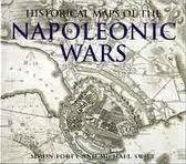
Historical Maps of the Napoleonic Wars
| Uitgeverij: | PRC Publishing |
|---|---|
| Uitvoering: | Paperback |
| Taal: | Engels |
| Aantal Pagina's: | 144 |
| Afmetingen: | 249x287x23 |
| Verschijningsdatum: | Augustus 2004 |
| EAN: | 9781856487337 |
Omschrijving
"A wonderful collection."--"Library Journal Based on the unique collection at the Public Record Office in Kew, England, this amazing assortment of more than 100 military maps charts the Napoleonic conflict from its start in 1803 to the defeat at Waterloo in 1815. Each one is beautifully hand drawn, accompanied by a caption explaining its significance. The maps reveal in fascinating detail how the events were plotted out, including the major battles at Trafalgar and Austerlitz. Follow the fighting and clashes on every front, including Germany, Russia, and Austria in the east, and the crucial encounters in Belgium. Simon Forty, a highly praised military writer, presents a concise history of both the war and military mapping. An essential compilation.